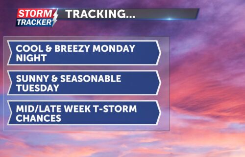
Tracking a seasonable start to the work week
Mostly sunny skies and above average temperatures Sunday afternoon will give way to a cool-off Sunday night, as a cold front traverses the region. An increase in cloud cover and a 20% chance of showers will accompany the cold front Sunday night and Monday morning, along with northwesterly breezes at 15 to 25 MPH. Low temperatures Monday morning will fall into the low 50s, and overcast skies will linger before sunshine returns late Monday afternoon. Highs Monday will reach the mid to upper 60s. Seasonably mild and dry conditions will continue Tuesday, with abundant sunshine and highs in the mid 60s. An active pattern is forecast to develop by the middle of next week, with chances for scattered t-storms returning to the region.