Tracking scattered t-storm chances
Warming temperatures and chances for scattered showers and thunderstorms will return for the second half of the work week. A few storms could be on the stronger side early Thursday morning and late Thursday evening, with hail being the primary hazard.
Partly cloudy skies and low 60s late Wednesday afternoon will give way to cooler conditions after sunset with lows falling into the lower 50s and southerly breezes at 5 to 10 mph. A 20% chance of thunderstorms will develop after midnight, and continue into Thursday morning.
Isolated t-storm chances will continue on Thursday, with otherwise partly sunny and warm conditions. Thursday afternoon highs will reach the upper 70s with southwesterly breezes at 10 to 20 mph.
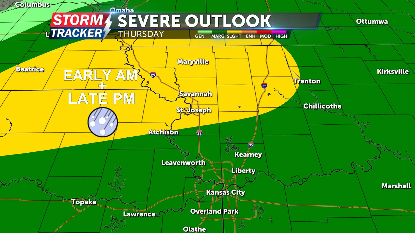
A 30% to 40% chance of t-storms will return Thursday evening, a few storms may be severe with pockets of sizable hail being the primary hazard.
Rain chances will exit the area for Friday, making way for sunny, balmy, and breezy conditions. Afternoon highs will reach the upper 70s Friday, with southwesterly winds of 20 to 30 mph.
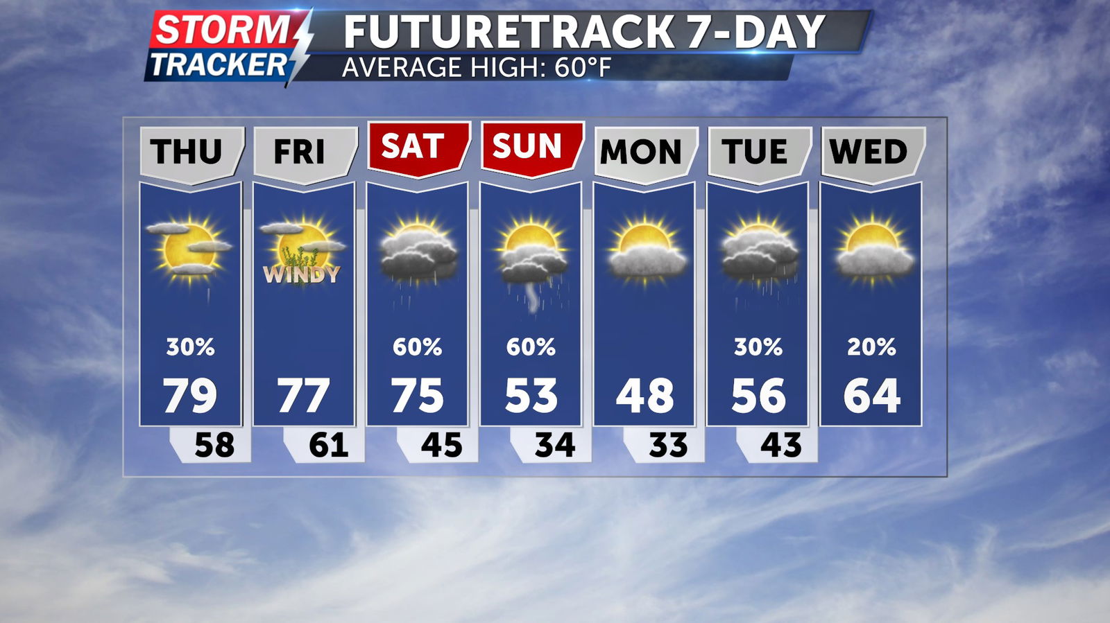
Widespread shower and thunderstorm chances will return for the weekend, bringing a risk for stronger storms mainly east of the I-35 corridor, and eventually cooler temperatures.


