Tracking rain, snow, and wind Wednesday evening
A strong low pressure system will continue to bring rain, snow, and gusty winds through Wednesday evening before sunshine returns Thursday.
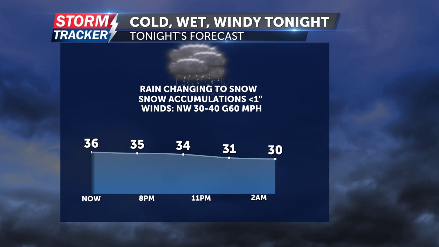
Rain showers late this afternoon will mix and change over to wet snow through the evening. Light accumulations of a dusting to 1 inch are possible across most of Northwest Missouri and Northeast Kansas.
Gusty winds of 40 to 60 mph will accompany the changeover to snow Wednesday evening. Temperatures will fall from the low 40s to the mid to low 30s through 9 PM, with wind chills falling well into the 20s.
High winds will subside late tonight, with clearing skies and lows dropping into the upper 20s by Thursday morning.
Sunshine will prevail Thursday, with northwest breezes at 10 to 20 mph and afternoon highs in the low to mid 50s.
ALERTS:
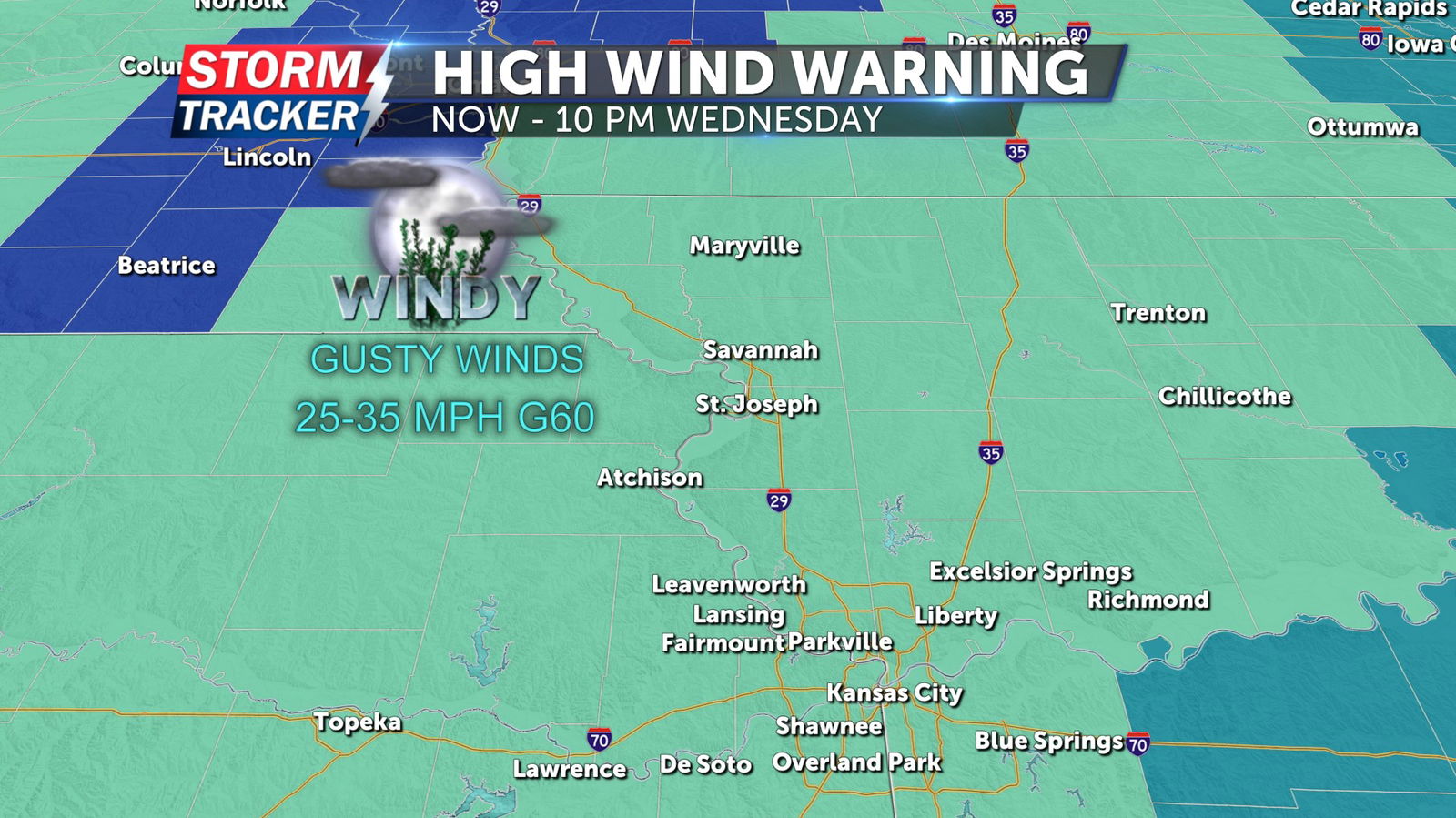
A High Wind Warning remains in effect for all of Northwest Missouri and Northeast Kansas from through 10 PM Wednesday. High wind gusts of 40 to 60 mph are forecast through the warning period. Scattered power outages, and difficult driving conditions are possible as winds ramp up.
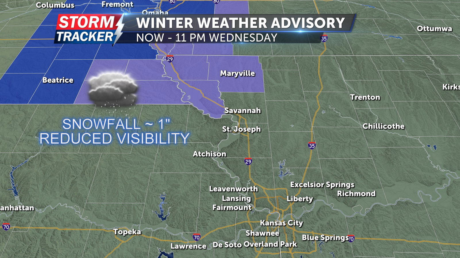
A Winter Weather Advisory remains in effect for Atchison, Nodaway, and Holt counties in Northwest Missouri, and Brown county in Northeast Kansas through 11 PM Wednesday. Snow accumulations of up to 1 inch are expected across the advisory area with locally higher totals. High winds and blowing snow could reduce visibility and make travel hazardous.


