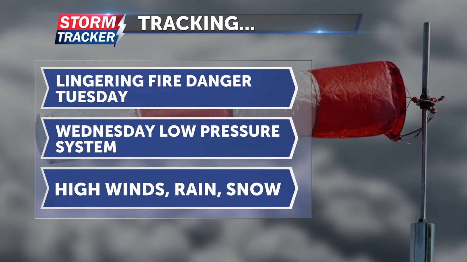
Tracking high winds, rain, snow mid-week
Warm, dry and windy conditions will continue to result in high fire danger Tuesday evening, ahead of a strong low pressure system forecast to bring high winds, rain, and wet snow on Wednesday.
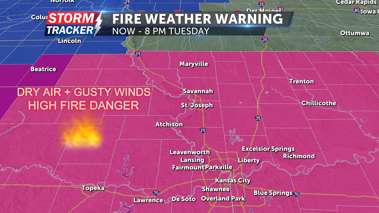
A Red Flag Warning remains in effect for all of Northwest Missouri and Northeast Kansas through 8 PM Tuesday. Burning is discouraged during these periods, as any fire could rapidly spread out of control due to low humidity, dry fuels, and gusty winds.
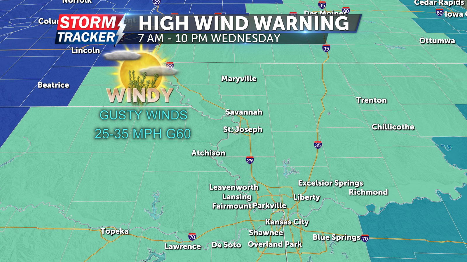
A High Wind Warning will go into effect for all of Northwest Missouri and Northeast Kansas from 7 AM to 10 PM Wednesday. High wind gusts of 40 to 60 mph are forecast through the warning period. Scattered power outages, and difficult driving conditions are likely as winds ramp up Wednesday.
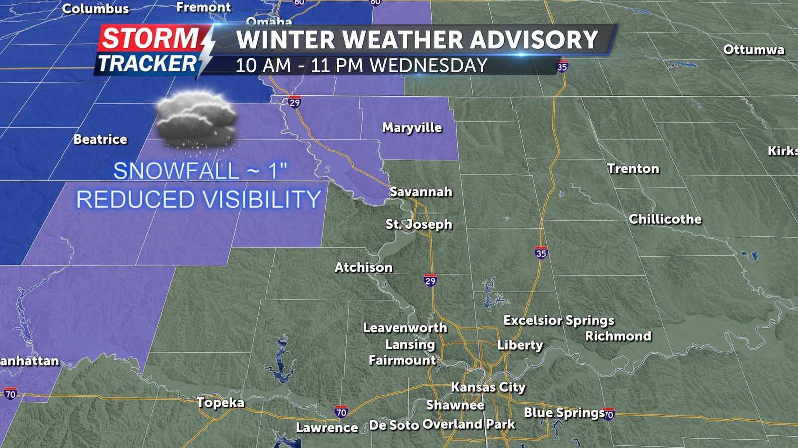
A Winter Weather Advisory has been issued for Atchison, Nodaway, and Holt counties in Northwest Missouri, and Brown county in Northeast Kansas from 10 AM to 11 PM Wednesday. Snow accumulations of up to 1 inch are expected across the warning area. High winds and blowing snow could reduce visibility and make travel hazardous.
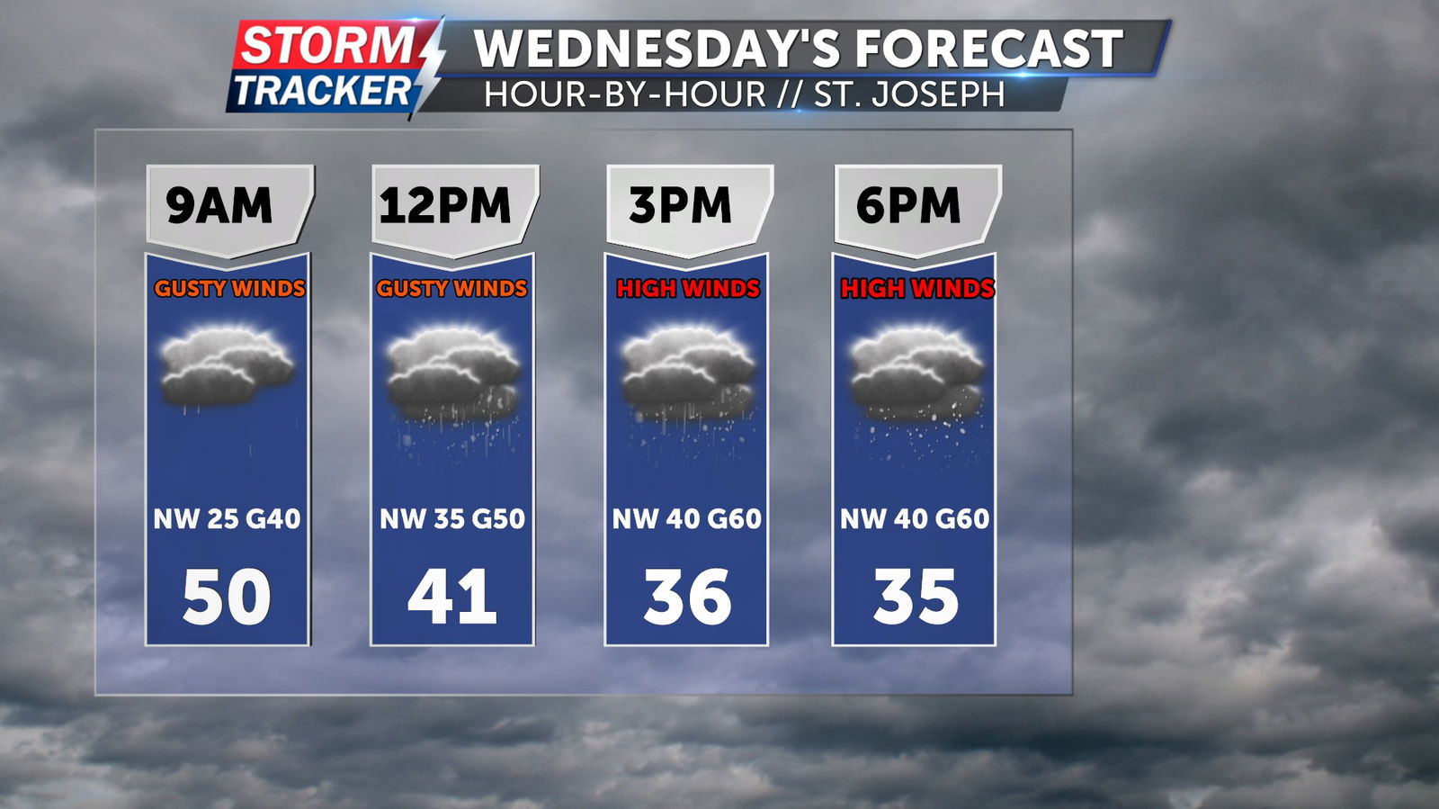
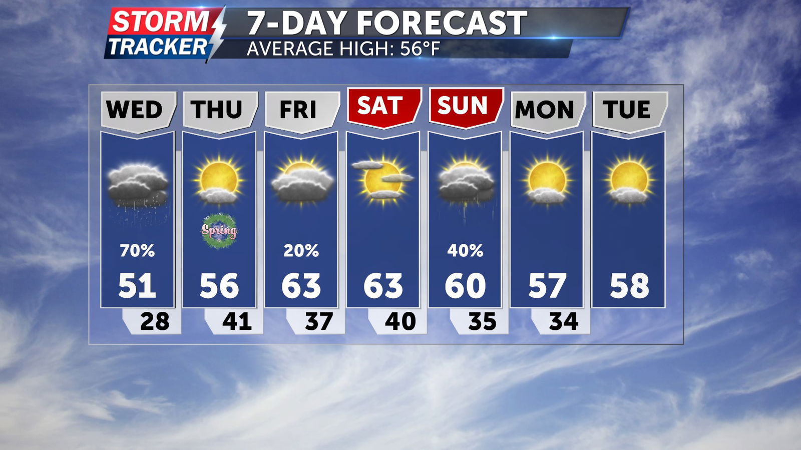
Temperatures will fall rapidly through the day Wednesday, with early morning highs in the 50s dropping into the mid 30s for the afternoon and evening.