Tracking gusty winds, scattered severe threat Friday
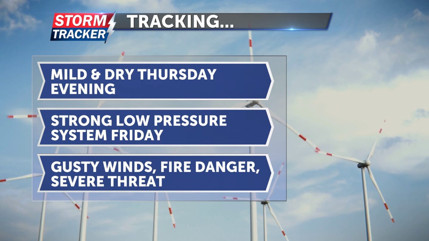
Dry and quiet conditions will linger Thursday evening, ahead of a strong low pressure system forecast to bring gusty winds, high fire danger, and a threat for scattered severe thunderstorms Friday.
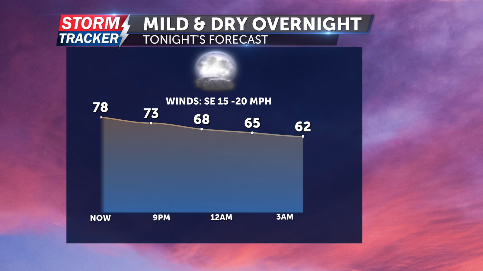
A sunny and toasty Thursday afternoon will give way to a mild evening, with skies remaining mostly clear overnight. Low temperatures will fall into the mid to upper 50s with southeasterly breezes at 10 to 15 mph.
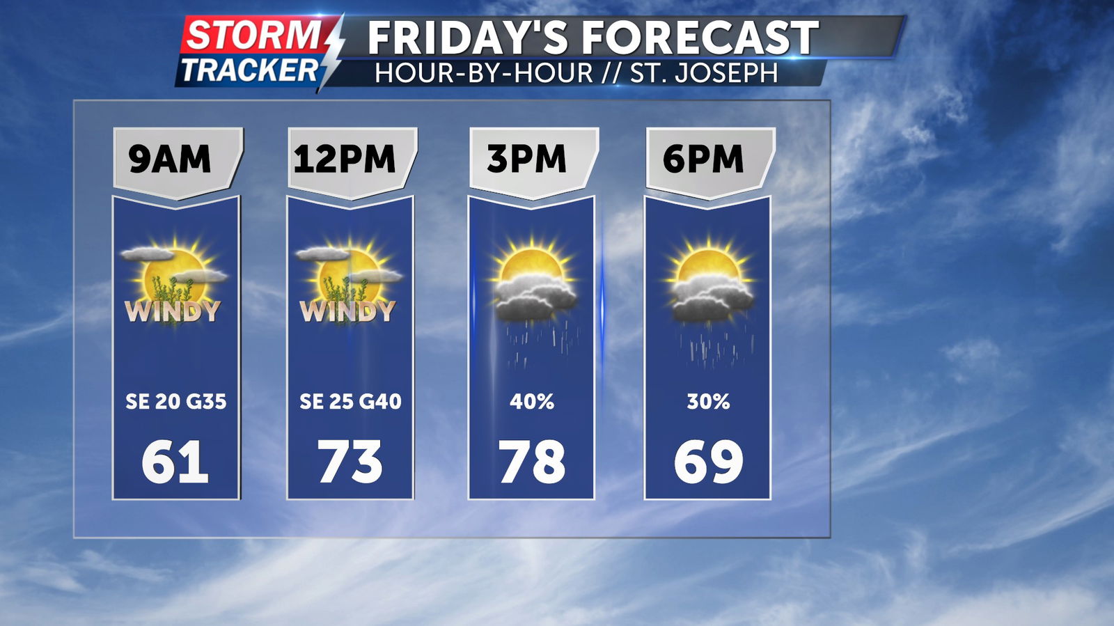
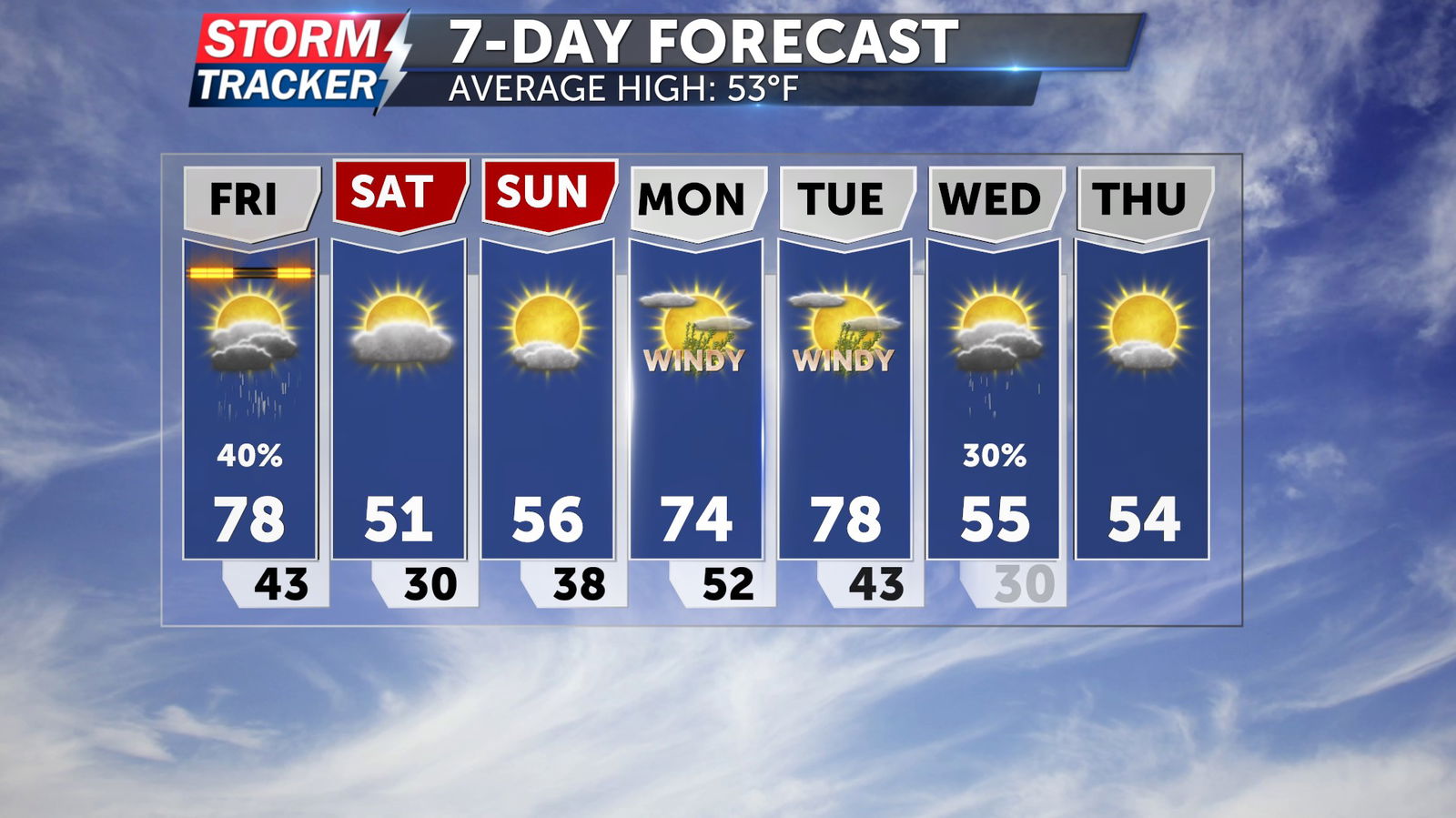
Gusty winds will develop through the day Friday, with partly sunny skies and afternoon highs in the mid to upper 70s. Southerly winds sustained at 20 to 30 mph could occasionally gust over 50 mph Friday afternoon.
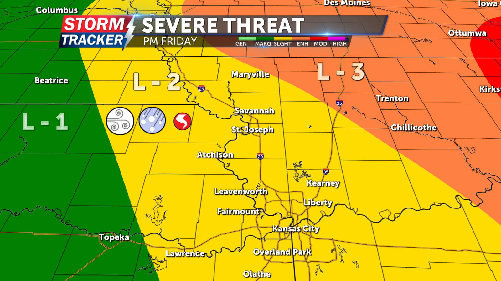
A 40% chance of scattered strong to severe thunderstorms will develop after 1 PM Friday and continue as late as 8 PM Friday evening. Primary hazards include damaging wind gusts and sizable hail, although an isolated tornado cannot be ruled out. More widespread impacts and a greater tornado threat will exist east of Interstate 35 Friday evening.

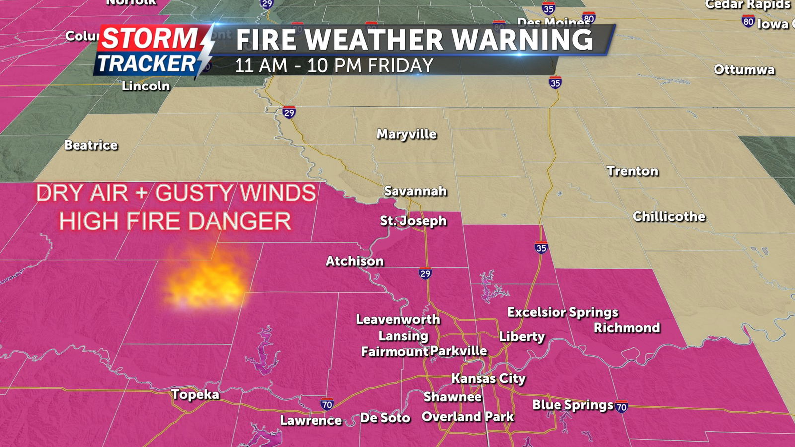
A Wind Advisory is in effect for counties along and adjacent to the Highway 36 corridor from 12 PM to 10 PM Friday. A Red Flag Warning has been issued along and south of the Highway 36 corridor from 11 AM to 10 PM Friday.
Cool and dry weather will return this weekend, with partly sunny skies, northerly breezes, and highs in the low 50s.