Severe weather preparedness: Damaging winds and hail
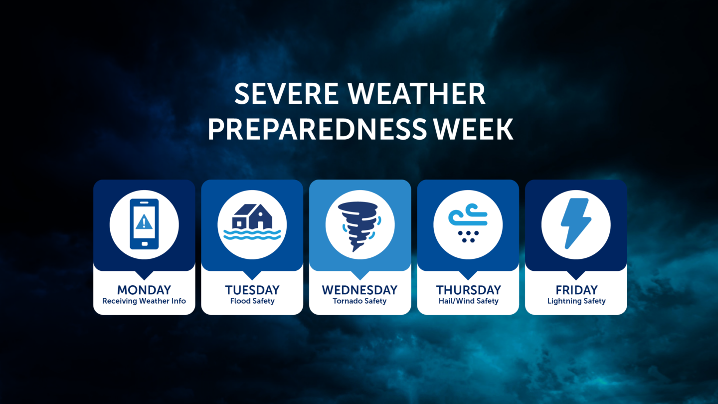
The topics of focus for the fourth day of severe weather preparedness week are damaging straight line winds and large hail, hazards that often accompany severe thunderstorms.
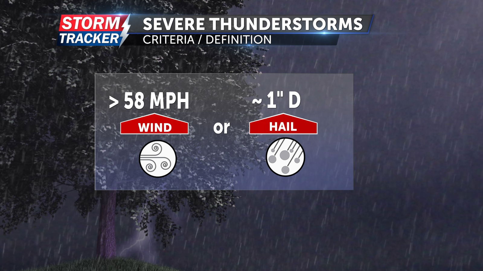
A thunderstorm is classified as severe when it produces hail greater than or equal to one inch in diameter and wind gusts of at least 58 mph.
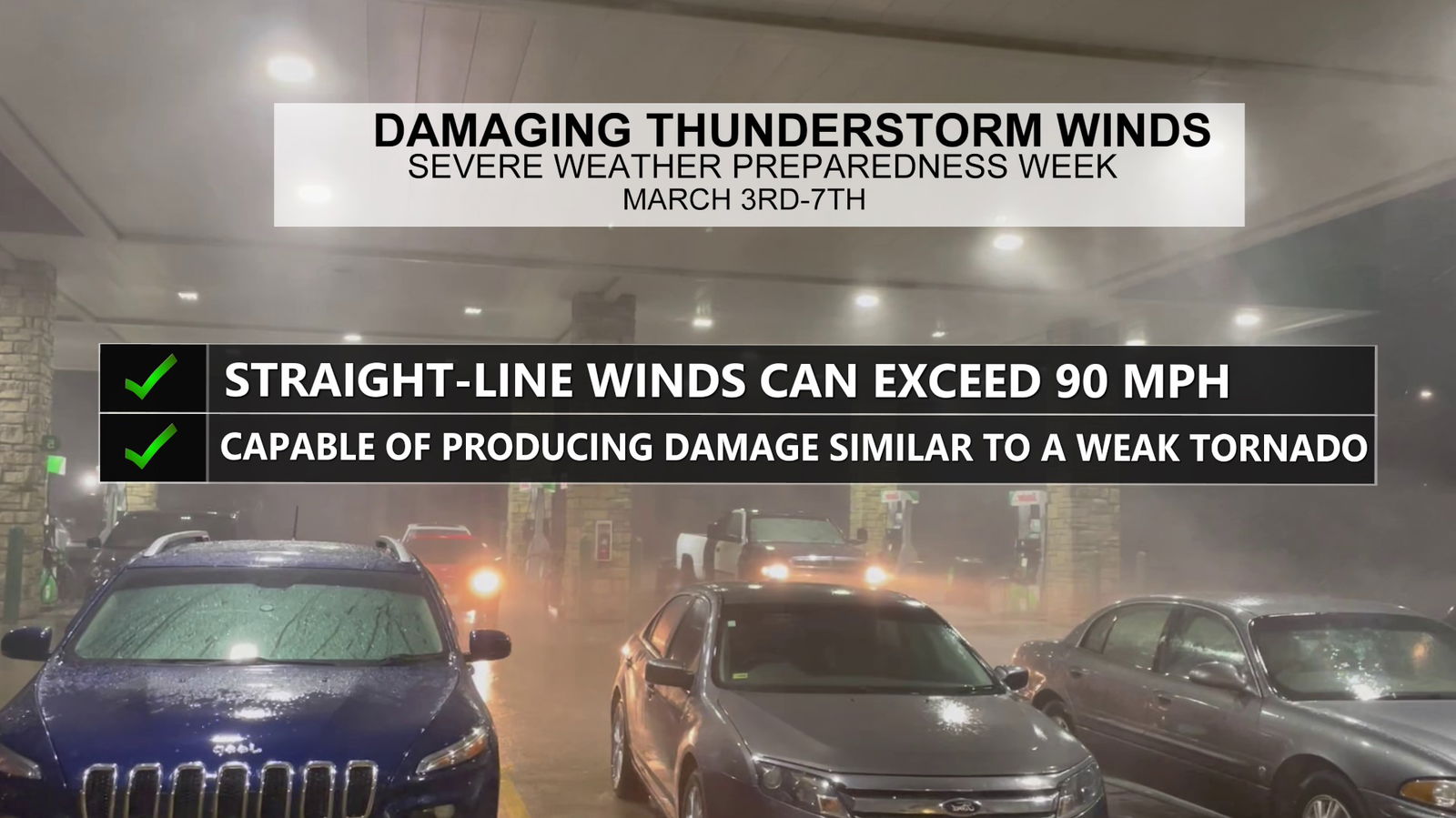
Damaging straight line winds most often fall between the 60 and 80 mph range, but can exceed 90 mph. In some cases, straight line winds impact large swaths of land, and produce damage similar to that of a weak tornado for hundreds of square miles.
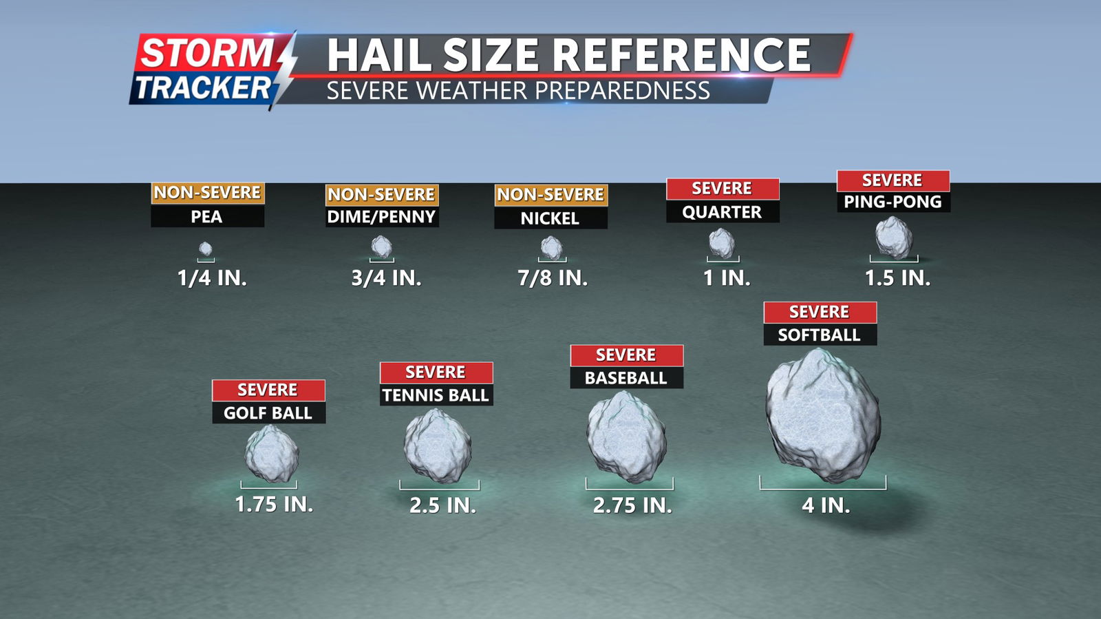
Severe hail most often reaches quarter to golf ball size, but can grow to be as large as a softball or grapefruit. Large hail is notorious for smashing windshields, and damaging roofs, but can also result in serious injury.
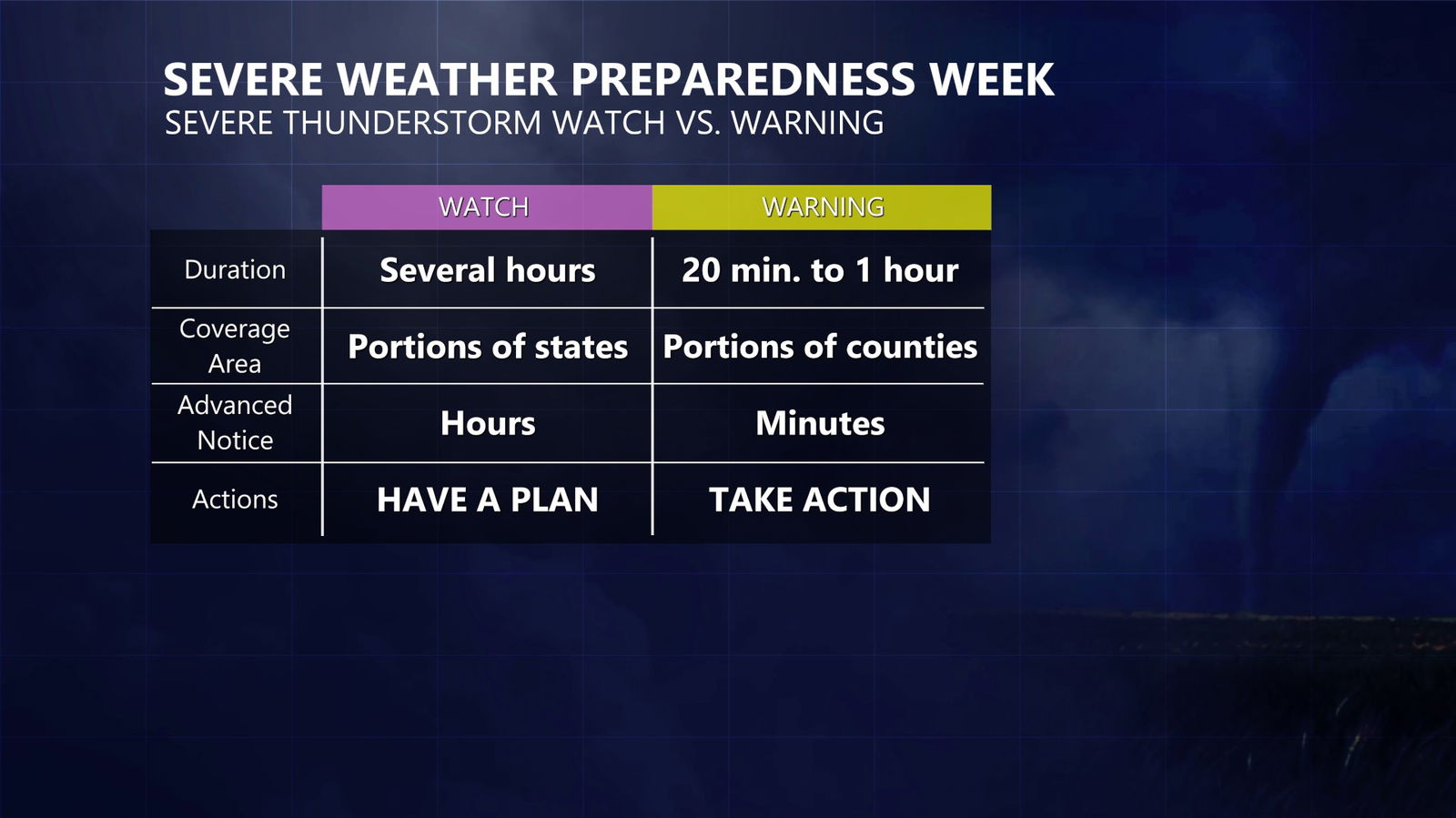
A severe thunderstorm watch is issued when conditions are favorable for severe thunderstorms to develop. These watches can be issued several hours before storms arrive, giving you time to prepare.
In contrast, a severe thunderstorm warning means a severe thunderstorm is occurring in or near your area. When a warning is issued, it's time to take action and find shelter immediately.
In the event a severe thunderstorm produces high winds and hail, the best course of action is to seek shelter in a permanent structure. Moving into an interior room away from windows can provide protection from falling trees or flying debris. It’s also important to remain aware of your surroundings, and act accordingly should high winds or large hail ramp up quickly during an otherwise garden variety thunderstorm.