Winter storm to bring impactful snow late tonight, Wednesday
An impactful winter storm is forecast to bring moderate to heavy snowfall to the Mid-Missouri River Valley starting late Tuesday night, through much of Wednesday.
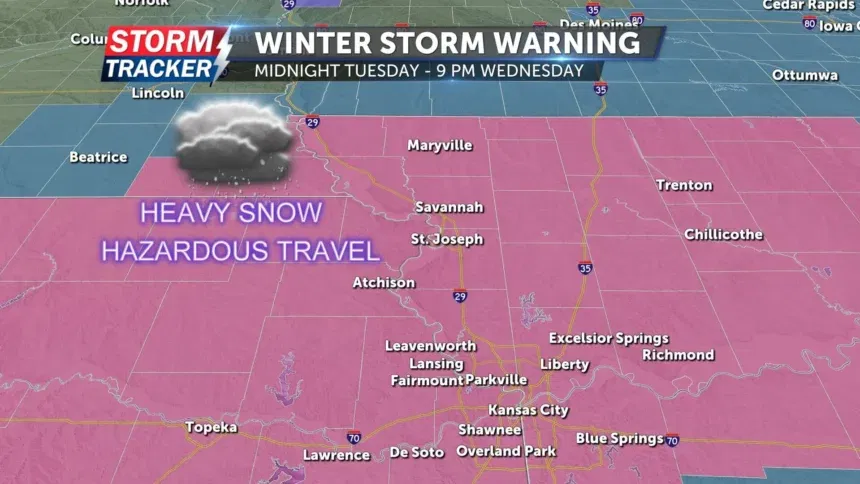
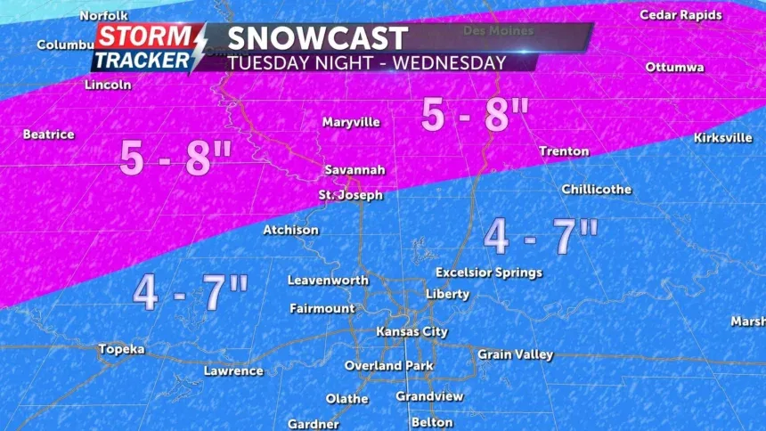
A Winter Storm Warning will go into effect for all of Northwest Missouri and Northeast Kansas from midnight Tuesday, Feb. 11 to 9 P.M. Wednesday, Feb. 12. Total snow accumulations of 4 to 8 inches are anticipated across the warning area from the Iowa border southward to the Kansas City metro, encompassing the entire Highway 36 corridor.
The highest snowfall totals are most likely along and north of Highway 36, where 5 to 8 inches of snow is forecast. Locations south of Highway 36 to the I-70 corridor are expected to receive 4 to 7 inches of snow, including the Kansas City metro. While snow is forecast along and north of I-70, a light glazing of ice will be possible in parts of central Missouri, well south of the I-70 corridor.
Difficult travel conditions are expected through the warning period due to snow covered roadways and reduced visibility. Wednesday morning and evening commutes will likely be impacted by the hazardous conditions. Consider avoiding travel Wednesday if at all possible. If you must travel, do so with extreme caution and have extra supplies on hand.
Bitterly cold air is forecast to arrive Wednesday night through much of Thursday, resulting in minimal melting and a likely continuation of tough travel conditions.


