Winter storm could lead to midweek mess
A small disturbance could bring up to an inch of snowfall to St. Joseph Monday night, but the bigger story is a storm coming Tuesday night into Wednesday.
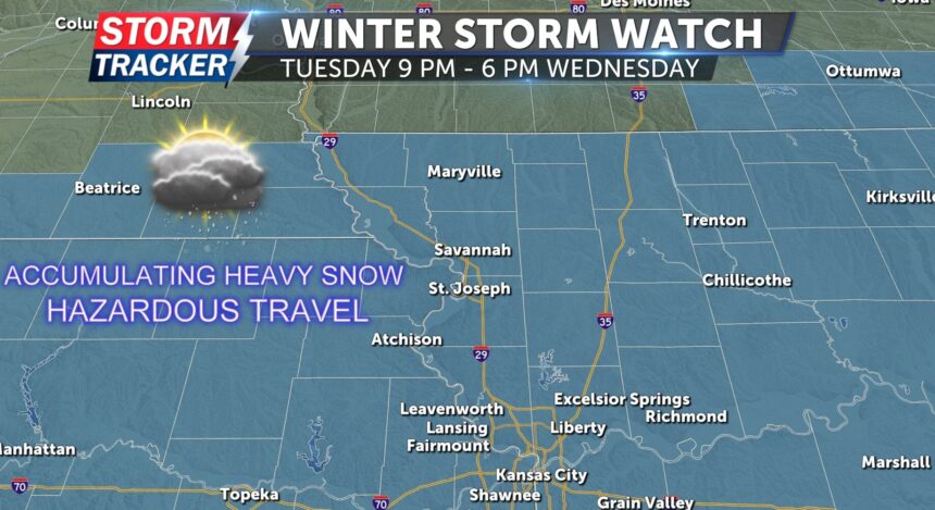
A winter storm watch is in effect for Northwest Missouri and Northeast Kansas ahead of a second round of winter weather. The watch begins at 9 p.m. on Tuesday and continues until 6 p.m. on Wednesday. The storm could dump 4 to 8 inches of snow from far northern Missouri to the Interstate 70 corridor, creating hazardous travel conditions and significant impacts across the area.
Travel could be dangerous due to heavy snowfall, especially for the morning and evening commutes on Wednesday. Residents are urged to prepare as the storm approaches.
City crews were pretreating streets Monday ahead of the weather's arrival.


