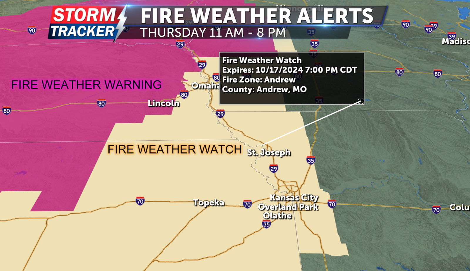
Fire Weather Watch issued for Thursday, Oct. 17
By Storm Tracker Meteorologist Payton Counts
As a surface high-pressure system moves southward, it will result in an associated wind shift within the upper-level flow of the atmosphere. In short, the surface wind is expected to transition from a northwestern to a southwestern direction.
This shift will make it easier for the transport of warm, dry air from the desert southwest. Given that St. Joseph has not experienced rainfall for nearly three weeks and is currently in a drought, this situation significantly elevates the risk of fire danger.
Thursday’s forecast indicates that winds could reach speeds of up to 25 miles per hour, with gusts potentially exceeding 30 miles per hour. On top of that, humidity levels are expected to remain between 20% and 30%. These conditions have prompted the National Weather Service to issue a Fire Weather Watch for the St. Joseph area, effective Thursday from 11 a.m. to 7 p.m. This watch can easily turn into a warning over the next 24 hours and Friday has the potential for a Fire Weather Watch as well.
The Storm Tracker weather team would heavily advise not to burn at all for the next several days.


