Strong storms possible Wednesday evening

By Meteorologist Jared Shelton
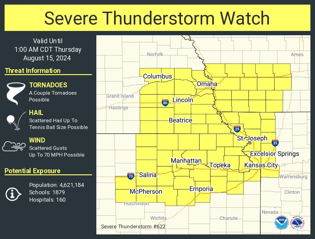
5:34 p.m. | A severe thunderstorm watch has been issued for Buchanan County and much of Northwest Missouri and Northeast Kansas. This is in effect until 1 a.m.
Scattered strong to severe thunderstorms are anticipated across Northwest Missouri and Northeast Kansas on Wednesday evening, and into the overnight hours. Here’s the latest on what Storm Tracker Chief Meteorologist Jared Shelton is tracking:
THREAT LEVEL: 2 (of 5)
TIMING: 7 p.m. – 1 a.m. (possible) / 9 p.m. – 12 p.m. (most likely)
PRIMARY HAZARDS: Damaging winds, spotty hail, locally heavy rain. A brief tornado cannot be ruled out early on.
DISCUSSION: Storms are expected to develop in a scattered manner west of the Missouri River after 6 p.m. on Wednesday evening, before increasing in coverage and progressing eastward through midnight. The primary hazards with any storms that develop will be damaging wind gusts, pockets of sizable hail, and locally heavy rainfall. While the tornado threat is on the lower end, a brief spin-up cannot be ruled out early on in the event, especially across far northwest Missouri.


