Light snow could lead to travel hazards Friday morning

By Meteorologist Jared Shelton
The first flakes of the month are expected across Northwest Missouri and Northeast Kansas early Friday morning, potentially leading to minor travel concerns as light accumulations are anticipated. Here’s the latest on what to expect:
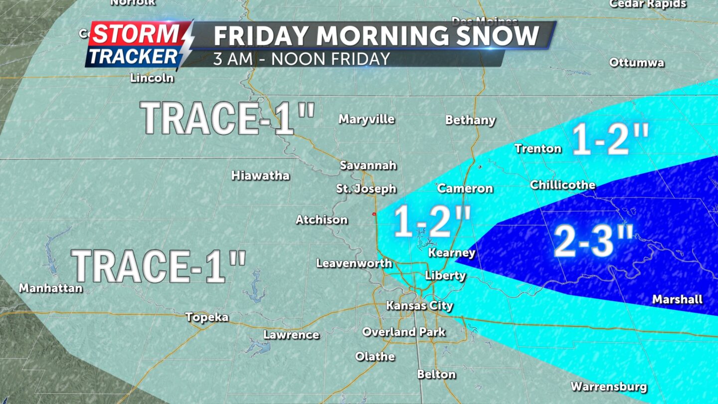
— TIMING: 3 a.m. to noon Friday: Light to moderate snow is expected to begin falling across parts of our viewing area as early as 3 a.m. Friday, becoming more widespread through the early morning hours before tapering off from west to east by noon.
— TOTALS: Trace to 1 inch: Light accumulations of a dusting to 1 inch are forecast across most of Northwest Missouri and Northeast Kansas including the city of St. Joseph by early Friday afternoon. Higher amounts of 1-3 inches are most likely along and east of the I-35 corridor where heavier snowfall rates are anticipated. A Winter Weather Advisory has been posted for portions of Northeast and North Central Missouri where greater impacts are expected.
— LOCAL TRAVEL IMPACTS: Light/moderate: Warm road temperatures and the short duration of this event will likely limit overall travel impacts for the St. Joseph area Friday morning. However, periods of low visibility and slick spots are still fairly likely through the early morning hours, especially on secondary roadways.


