Drivers urged to use caution as snow blows in

By Jared Shelton
Winter weather alerts remain in place across Northwest Missouri and Northeast Kansas as an impactful snowfall event unfolds this afternoon and continues through much of Tuesday.
Here’s the latest on expected conditions:
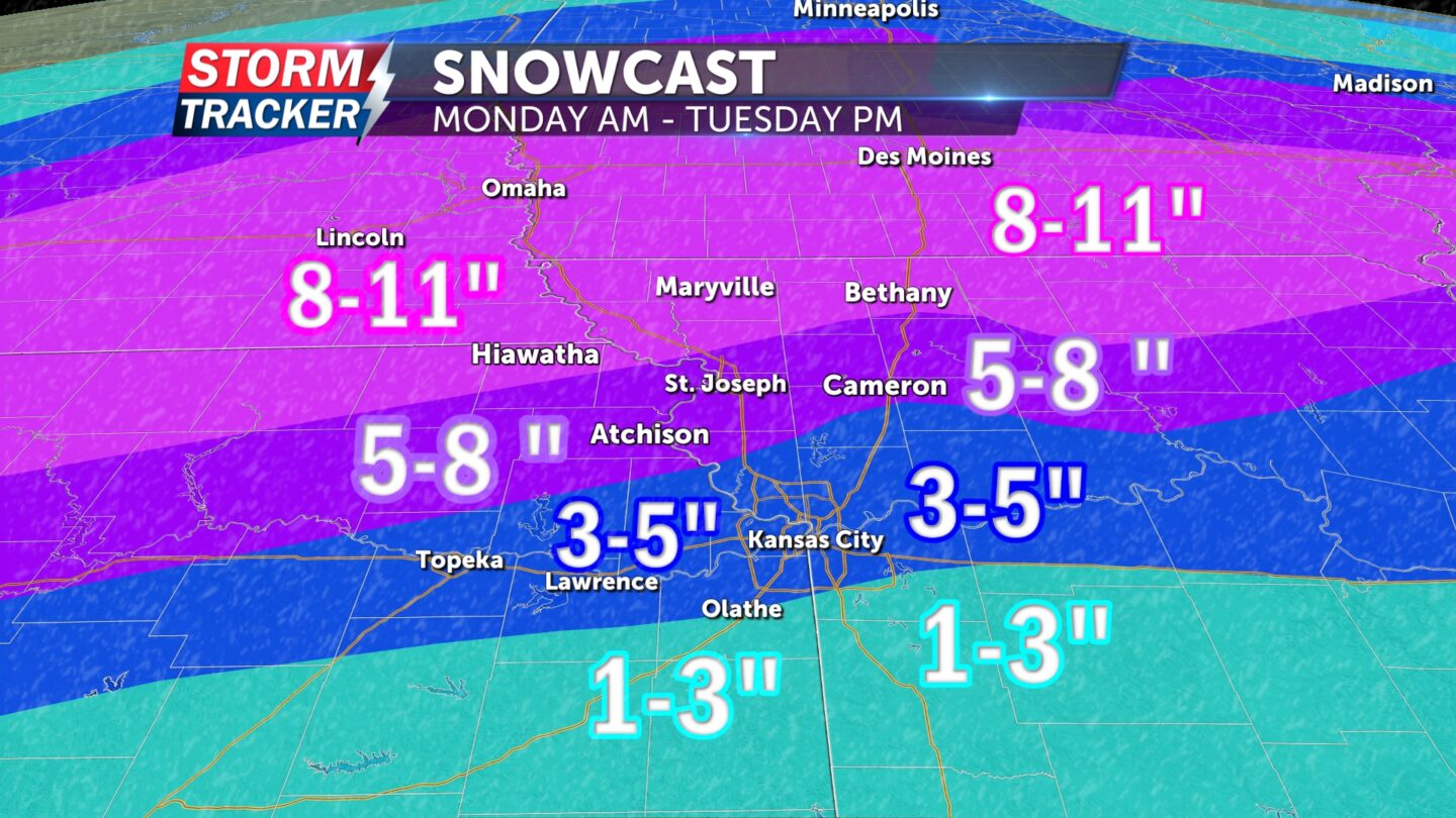
WINTER STORM WARNING 9 A.M. MONDAY THROUGH 6 P.M. TUESDAY: Issued for locations along and north of Interstate 70 including Kansas City and St. Joseph where 5 to 11 inches of snow and 45 mph wind gusts are possible. The heaviest snowfall totals are expected along and north of Highway 36 where 6-plus inches of accumulation will be most common by late Tuesday morning.
WINTER WEATHER ADVISORY NOON MONDAY THROUGH 6 P.M. TUESDAY: Issued for points south of I-70 where 2 to 4 inches of snow and 45 mph wind gusts are anticipated.
TIMING: Light rain and snow have begun to pick up in intensity and change over to all snow creating minor travel concerns as of this afternoon. Near-freezing temperatures are expected to drop well below freezing later tonight, with periods of heavy blowing snow developing after midnight making for hazardous travel through Tuesday morning and perhaps into Tuesday afternoon.
UNCERTAINTY: The exact track of this system will determine when temperatures drop well below freezing, which will have implications on snow totals overall. A shift in the track a bit further north would prolong periods of rain mixing with snow and ultimately limit snowfall totals locally, bringing the heaviest snow closer to the Missouri-Iowa border. If the system tracks further south, there is the potential for heavier totals extending to the I-70 corridor.
BOTTOM LINE: Hazardous travel conditions are developing across Northwest Missouri and Northeast Kansas this afternoon and will continue to deteriorate through Tuesday morning.


