Storm warning issued as impactful snow moves into St. Joseph area

By Jared Shelton
Winter weather alerts have been posted across Northwest Missouri and Northeast Kansas in anticipation of an impactful snowfall event expected to unfold throughout the day Monday into Tuesday.
Here’s the latest on expected conditions:
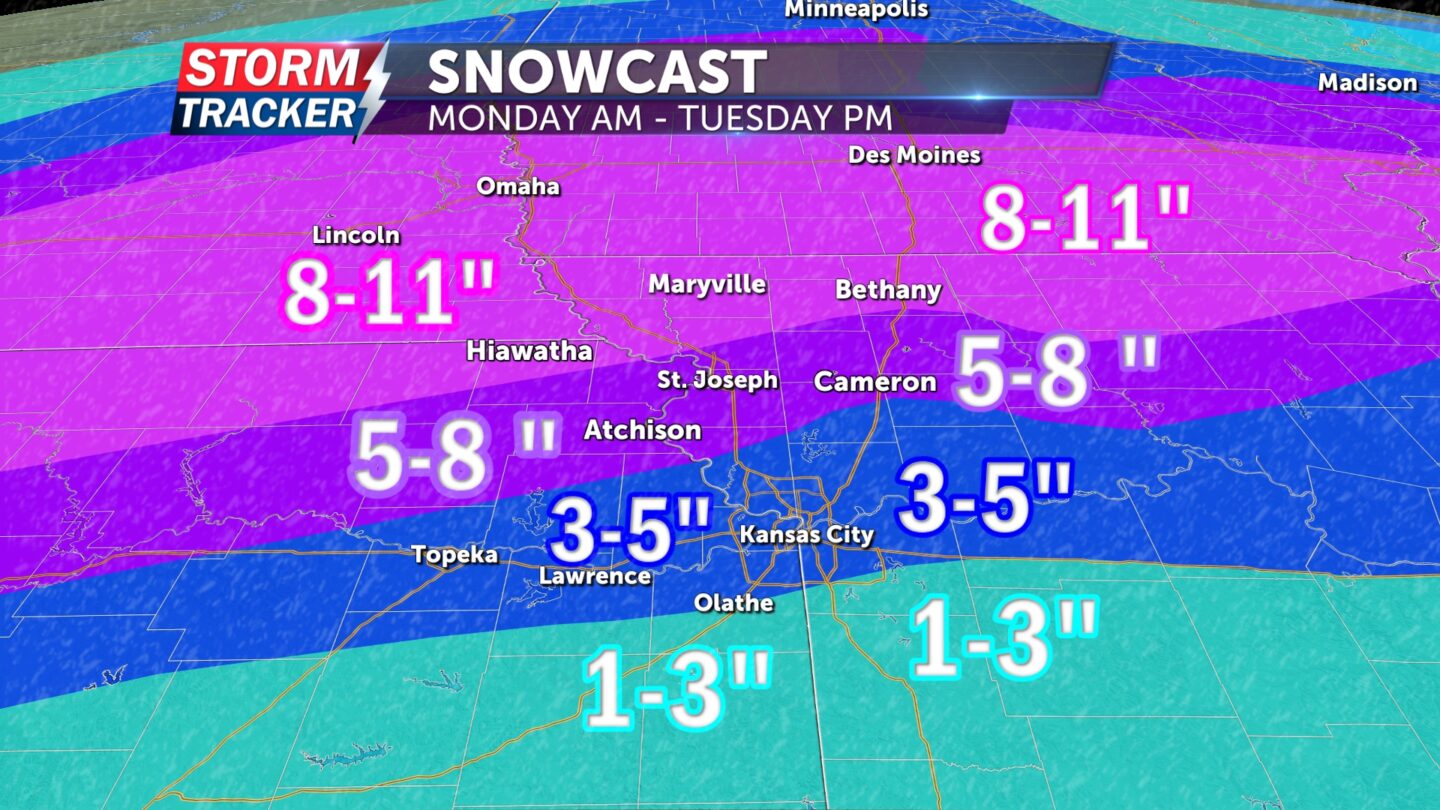
WINTER STORM WARNING 9 A.M. MONDAY THROUGH 6 P.M. TUESDAY: Issued for locations along and north of Highway 36 including Buchanan County and St. Joseph where 5 to 11 inches of snow and 45 mph wind gusts are anticipated.
WINTER WEATHER ADVISORY 9 A.M. MONDAY THROUGH 6 P.M. TUESDAY: Issued for the Kansas City metro roughly along and south of 1-70 where 2 to 5 inches of snow and 45 mph wind gusts are anticipated.
TIMING: Light rain and snow are expected across the area Monday morning leading to minor travel impacts, especially along and south of Highway 36 where temperatures will be near to just above freezing. Precipitation will pick up in intensity and begin changing over to all snow by Monday night, with periods of heavy blowing snow making for hazardous travel through Tuesday morning and perhaps into Tuesday afternoon.
UNCERTAINTY: The exact track of this system will determine when rain changes over to snow, which will have implications on snow totals overall. A shift in the track a bit further north would prolong periods of rain and ultimately limit snowfall totals locally, bringing the heaviest snow closer to the Missouri-Iowa border. If the system tracks further south, there is the potential for an all-snow event from start to finish which would increase overall snow totals.
BOTTOM LINE: Be prepared for the possibility of hazardous travel conditions and scattered power outages Monday morning through Tuesday afternoon.


