Multi-hazard storm system arriving Friday

A strong low pressure system forecast to bring gusty winds, high fire danger and a threat for scattered severe thunderstorms Friday.
Strong southerly winds and elevated fire danger are expected to develop late Friday morning and persist through the evening hours.
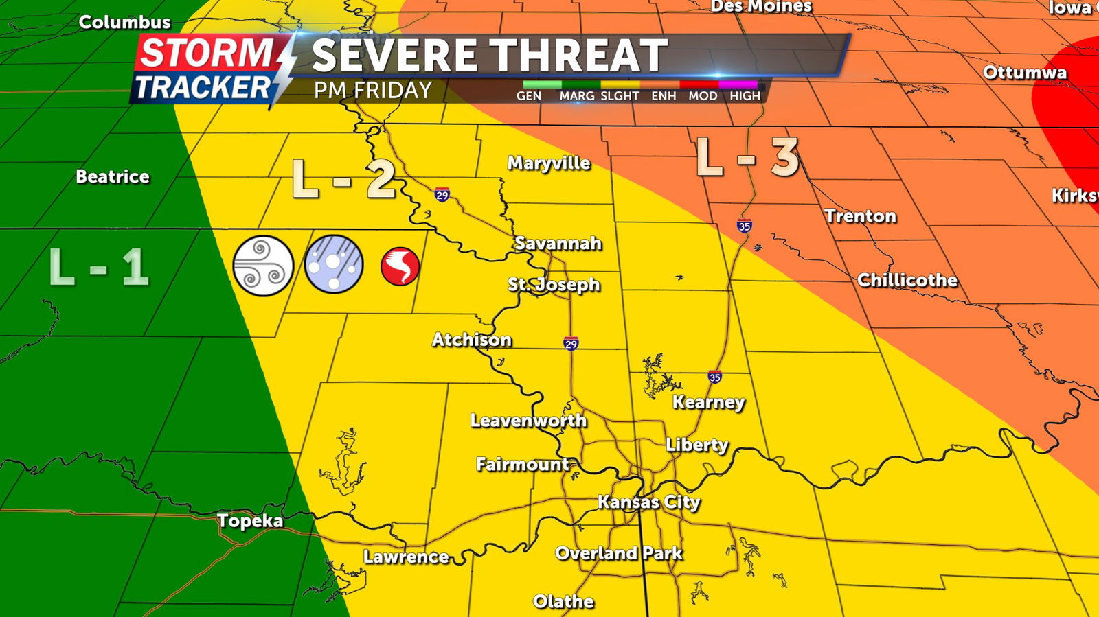
A risk for scattered severe storms will ramp up after 2 p.m. and continue as late as 7 p.m. Friday. Primary hazards include damaging winds and sizable hail, although an isolated tornado cannot be ruled out.
Multiple alerts have been issued across Northwest Missouri and Northeast Kansas ahead of the active weather.

A Wind Advisory is in effect for counties along and adjacent to the Highway 36 corridor from 12 to 10 p.m. Friday, March 14. Sustained winds of 20 to 30 mph are forecast through the period, with gusts of up to 55 mph.
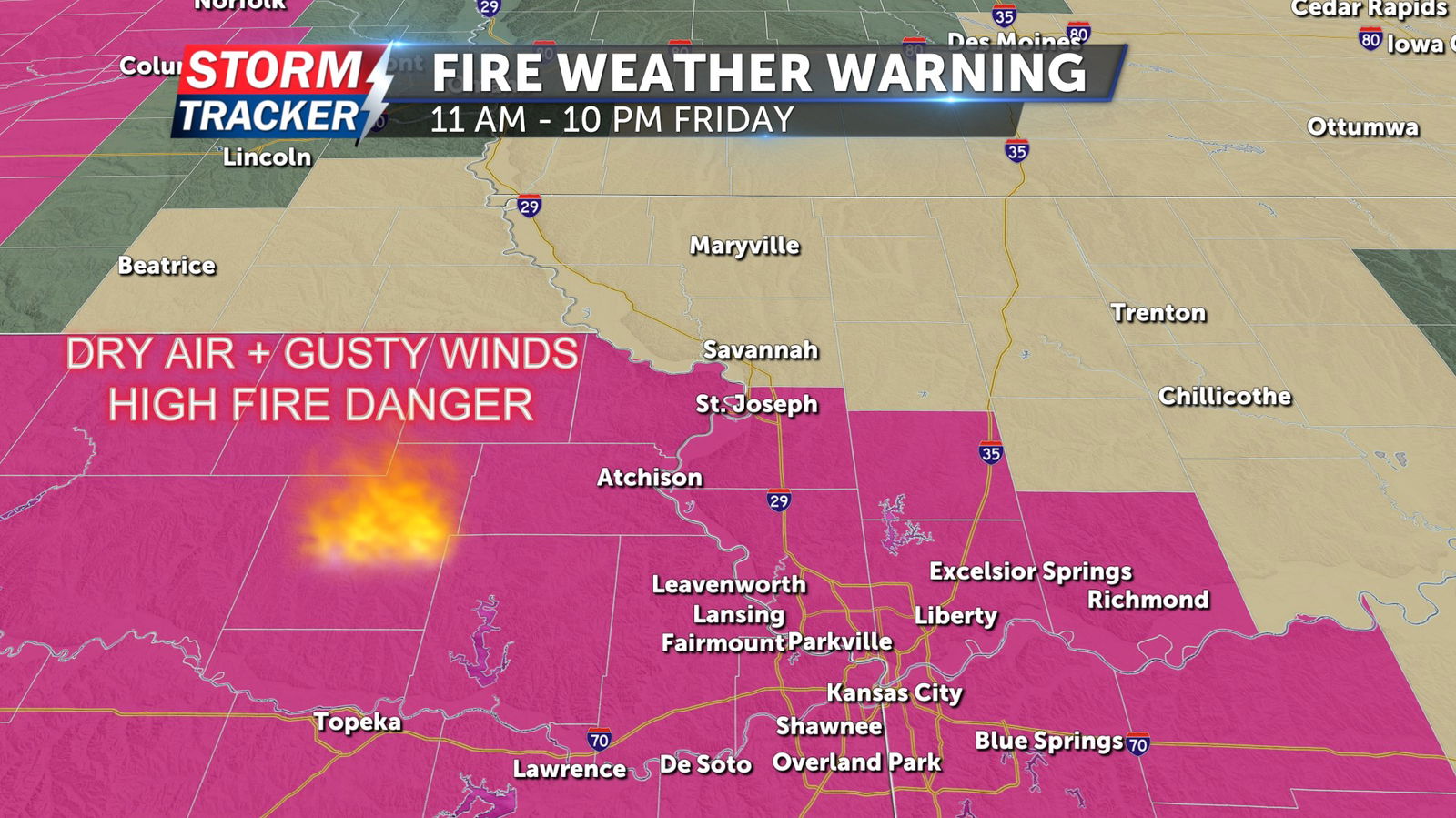
A Red Flag Warning has been issued along and south of the Highway 36 corridor from 11 a.m. to 10 p.m. Friday, March 14. Low relative humidity, gusty winds, and dry fuels will lead to critical fire weather conditions. Outdoor burning of any kind is discouraged, as fires could rapidly spread out of control.


