
Tracking cool and rainy Easter weekend
Tracking cool and rainy Easter weekend
Continue Reading Tracking cool and rainy Easter weekend
Continue Reading
This morning, moderate rainfall produced about a tenth of an inch of precipitation in St. Joseph. As we move through the rest of the day, it will be warm and windy. Southerly winds will move into the area, sustaining between 15 and 25 mph, keeping temperatures toasty this afternoon. Highs will reach the mid-80s. Tonight,
Continue Reading
Widespread rainfall and thunderstorms began this morning and are expected to taper off later in the morning. Storms still have the potential to produce heavy rain, gusty winds, and sizable hail. Conditions will dry out by the mid-morning, and southerly winds will sustain between 15 and 25 mph. These winds will help keep temperatures warm
Continue Reading
Tracking multiple rain chances this week
Continue Reading
April 14, 2025 Pet Pals
Continue Reading
Tracking a seasonable start to the week
Continue Reading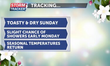
Tracking toasty temperatures Sunday: seasonable again next week
Continue Reading
Tracking a seasonable day: Warming up this weekend
Continue Reading
ST. JOSEPH, Mo. (News-Press NOW) — As spring has settled in, many people find themselves sniffling and sneezing. Why? Pollen — the powdery substance that triggers seasonal allergies. Though it’s often seen as a nuisance, pollen plays an important role in nature. It’s essential for plant reproduction and supports ecosystems, especially pollinators like bees. Spring
Continue Reading
Tracking windy conditions and mild temperatures
Continue Reading
This morning, skies will start off mostly cloudy, but clouds will decrease throughout the day. Temperatures are much milder this morning. Afternoon highs will still climb into the mid-70s, even though a weak and dry cold front will move through this afternoon, shifting winds from the southwest to the northwest. Winds will sustain between 10
Continue Reading
Tracking sunshine and seasonable temperatures
Continue Reading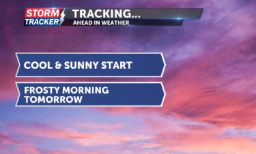
Tracking a cool and sunny start
Continue Reading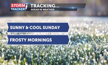
Tracking cold nights and sunny days ahead
Continue Reading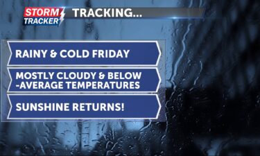
Tracking widespread showers and below-average temperatures
Continue ReadingTracking cool temperatures and more rain chances
Continue Reading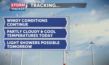
This morning, light to moderate rain has been tracking out of the northeast portions of Kansas and looks like it could clip St. Joseph, bringing some light rain to our area for the next hour or so. Temperatures will be cool, reaching the mid-60s. Some passing clouds are expected today, with a bit more sunshine
Continue Reading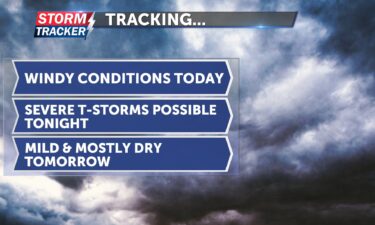
Tracking gusty winds and strong storms tonight
Continue Reading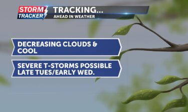
This morning, we start with cloudy skies and cold temperatures. More sunshine will appear this afternoon as clouds decrease. Afternoon highs will be cool, reaching only the mid-50s. Winds will be breezy from the north at 5 to 10 mph. Tomorrow will be warmer but windy. Skies will be cloudy, and winds will be gusty
Continue Reading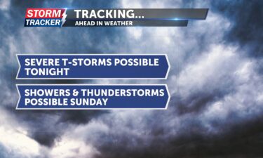
This evening, between 8 p.m. and 10 p.m., there is a chance of isolated to scattered thunderstorms, with the potential for sizable hail and damaging wind gusts. Tonight, temperatures will remain warm for most of the evening before an incoming cold front knocks them down overnight and into tomorrow. Lows tonight will reach the low
Continue Reading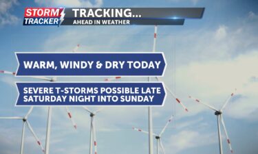
Tracking warm, windy, and dry conditions; thunderstorm chances late Saturday
Continue Reading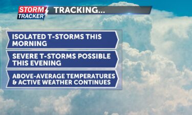
This morning, there is a slight chance of isolated, low-end thunderstorms. Afternoon highs will push into the upper 70s and could even reach the low 80s. It will be toasty and breezy today, with south winds sustaining between 10 and 15 mph. Later this afternoon, there is a chance of more isolated thunderstorms, which could
Continue Reading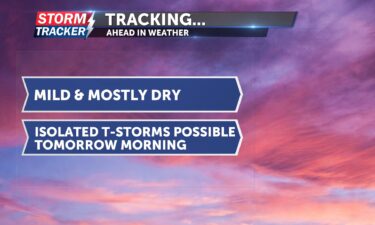
Tracking mild and mostly dry skies today: isolated thunderstorms possible tomorrow
Continue Reading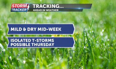
Tracking mild and dry mid-week: Thursday brings chances for thunderstorms
Continue ReadingTracking a warm and windy day
Continue Reading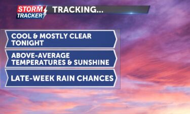
Tracking above-average temperatures and dry skies early this week
Continue Reading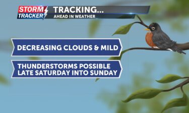
Tracking mild and dry conditions: thunderstorms possible on Saturday
Continue Reading
Winter is well known for its cold and gloomy days but also for its different types of precipitation. Freezing rain, sleet and snow are typical of the season. So far this winter, we have experienced a glaze of freezing drizzle, a few pellets of sleet and mounds of snow. Weather can be tricky and hard
Continue Reading Feb. 2, was Groundhog Day, a tradition many look forward to after enduring the harsh cold of winter. For more than a century, Punxsutawney Phil has been making his famous “weather predictions” from a small town in eastern Pennsylvania, adding a touch of fun and folklore to the winter season. Punxsutawney Phil is not the
Continue Reading A strong low-pressure system ripped through America’s heartland earlier this week, bringing a multitude of hazards and impacts. Tornadoes and severe thunderstorms made headlines on the southern flank of the sprawling spring storm, while blizzard conditions plagued points farther north. Locally, the storm brought over an inch of rain, one to three inches of snow
Continue Reading