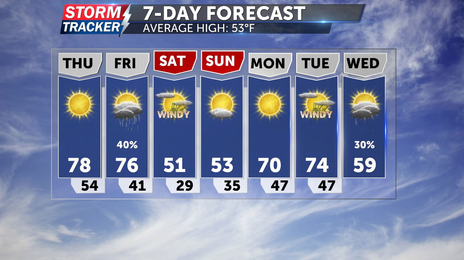
Tracking March warmth, late week wind and storms
Above average temperatures and sunshine will continue on Thursday, before a strong low pressure system brings gusty winds and a chance for scattered strong storms on Friday.
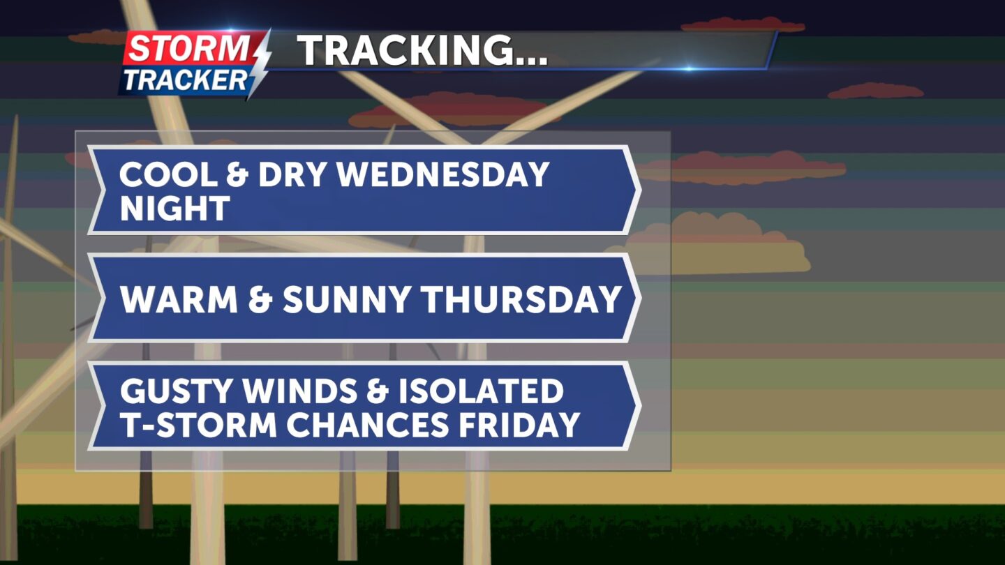
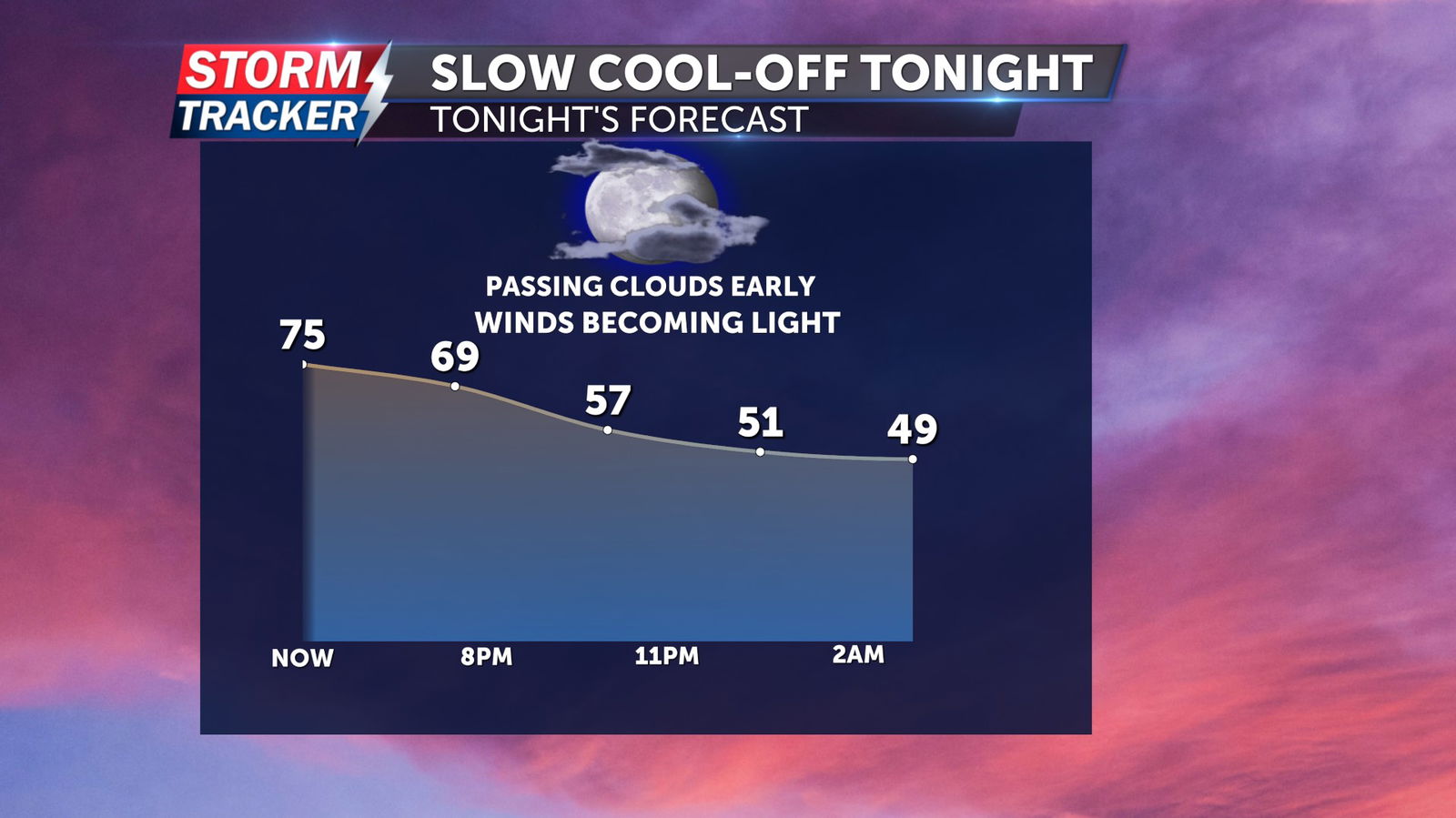
Passing clouds Wednesday evening will give way to clear skies late, with overnight lows dropping into the mid to low 40s after midnight and light easterly breezes.
Abundant sunshine will return Thursday, with afternoon highs reaching the upper 70s and light southeasterly winds.
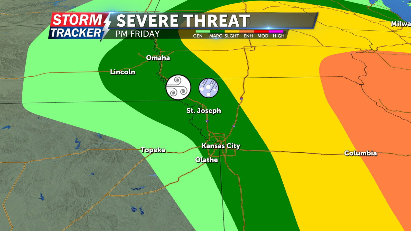
Southerly winds will increase and become gusty on Friday as a low pressure system approaches Northwest Missouri and Northeast Kansas. Friday afternoon and evening will bring a 40% chance for scattered strong storms. The highest severe threat exists along and east of the I-35 corridor, although damaging winds and sizable hail will be possible along and east of the Missouri River through early Friday evening.