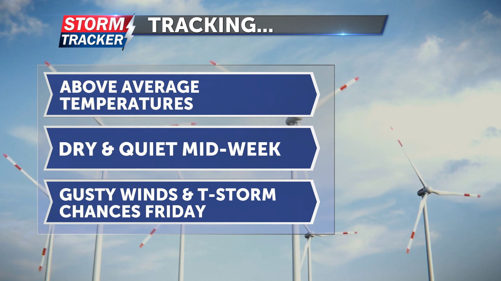
Tracking a mild and dry mid-week

Above average temperatures and fair skies will make for a warm and dry mid-week, before gusty winds and chances for showers and thunderstorms return Friday.
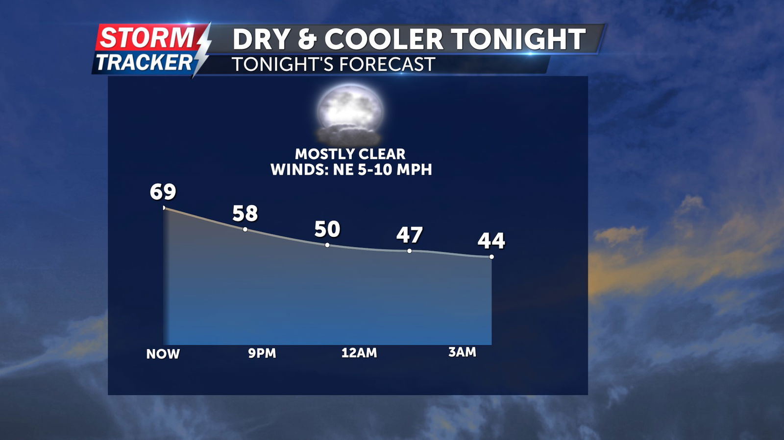
Upper 60s and sunshine late Tuesday afternoon will give way to a cool off after sunset, with mostly clear skies continuing. Overnight lows will fall into the upper 30s to low 40s by early Wednesday morning, with light northeast winds at 5 - 10 mph.
Aside from a few passing afternoon clouds, sunshine will prevail Wednesday with afternoon highs in the low to mid 70s and light easterly breezes.
Sunshine will stick around Thursday and unseasonably warm temperatures will return for the afternoon with highs in the mid 70s.
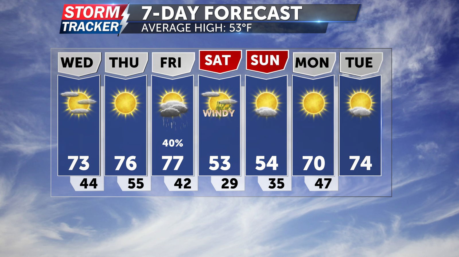
Friday will bring gusty southerly winds and more warmth ahead of a cold front, which will introduce a chance for showers and t-storms before bringing a cool off by the weekend.